Geodetic Calculation Feature Improvement
To expand on the existing geodetic capabilities of the FPAssistant Suite SDK and to comply with FAA Order 8260 the GeoCoordinate and GeoCoordinateBasic objects (Structs) now support geodetic calculations based on Appendix A. TERP Standard Formulas for Geodetic Solutions. As documented in the appendix, it states…
>> Algorithms and methods are described for calculating geodetic locations (latitudes and longitudes) on the World Geodetic System of 1984 (WGS‐84) ellipsoid, resulting from intersections of geodesic and non-geodesic paths. These algorithms utilize existing distance and azimuth calculation methods to compute intersections and tangent points needed for area navigation procedure construction. The methods apply corrections to an initial spherical approximation until the error is less than the maximum allowable error, as specified by the user.<<
This allows the developer to chose between using the FAA based algorithms or the CS-MAP library.
Unit Testing
As the FAA include many tables of test data, these have been added to unit testing environment along with further internal testing to derive a high code coverage percentage for the software.
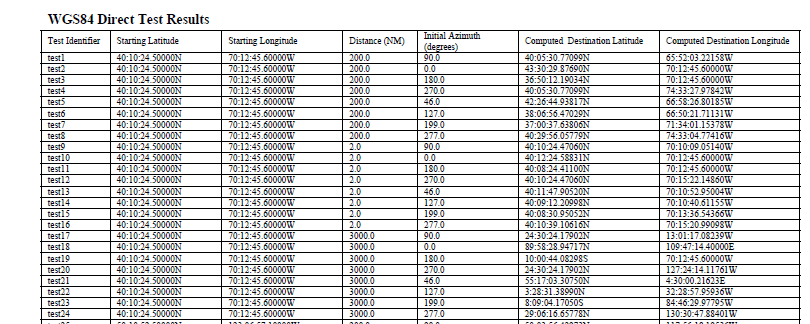
FAA WGS4 Direct Test Results
Using the tabular data, this is then entered into Visual Studio so that tests against the FPAssistant SDK can performed and inaccuracy’s found.
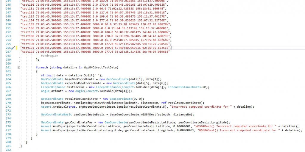
Showing test data along with a C# loop that tests each result in the calculations with the table
