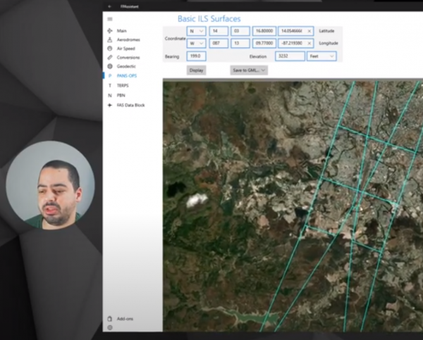
Here is a good blog written by Antonio Locandro who used FPAssistant App to create a ICAO PANS-OPS Basic ILS set of surfaces and then imported into QGIS and then exported as 3D KML for display in Google Earth. This shows workflows of what can be achieved using free tools.
Click here to read the blog entry and view the video on YouTube
Blog Video
About Antonio….
Civil Engineer graduated from the Universidad Nacional Autónoma de Honduras (UNAH @2008) with an unfinished Masters in Project Management from UNITEC Honduras (about 80% of pensum) , working since 2008 on Civil Aviation matters in which I mainly do Aeronautical Cartography including AIXM, GIS Database, ICAO PANS -OPS procedure design (Conventional and PBN) for the departure and approach of aircraft, obstacle assessment, etc. I also did consulting work related to this fields and GIS including past projects for ICAO Technical Cooperation Bureau (TCB).
Freelance ICAO PANS-OPS and PBN work including training around the world for Instrument Flight Procedure Design (Singapore, Costa Rica and Guyana).
He has over 10 years of experience working with GIS (ESRI, QGIS, Postgis) and have recently become interested in using open source software and programming like python, javascript, HTML & CSS.
